


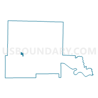
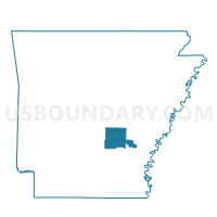
P411 Voting District, Jefferson County, Arkansas
About
Outline

Summary
| Unique Area Identifier | 526850 |
| Name | P411 Voting District |
| County | Jefferson County |
| State | Arkansas |
| Area (square miles) | 1.26 |
| Land Area (square miles) | 1.25 |
| Water Area (square miles) | 0.00 |
| % of Land Area | 99.81 |
| % of Water Area | 0.19 |
| Latitude of the Internal Point | 34.24226720 |
| Longtitude of the Internal Point | -92.07955690 |
Maps

Graphs
Select a template below for downloading or customizing gragh for P411 Voting District, Jefferson County, Arkansas


Neighbors
Neighoring Voting District (by Name) Neighboring Voting District on the Map
- P 722 Voting District, Jefferson County, AR
- P406 Voting District, Jefferson County, AR
- P409 Voting District, Jefferson County, AR
- P412 Voting District, Jefferson County, AR
- P413 Voting District, Jefferson County, AR
- P414 Voting District, Jefferson County, AR
- P417 Voting District, Jefferson County, AR
- P418 Voting District, Jefferson County, AR
- P422 Voting District, Jefferson County, AR
- P423 Voting District, Jefferson County, AR
- P70 Voting District, Jefferson County, AR
- P710 Voting District, Jefferson County, AR
- P81 Voting District, Jefferson County, AR
Top 10 Neighboring County Subdivision (by Population) Neighboring County Subdivision on the Map
Top 10 Neighboring Place (by Population) Neighboring Place on the Map
Top 10 Neighboring Unified School District (by Population) Neighboring Unified School District on the Map
- Watson Chapel School District, AR (17,064)
- White Hall School District, AR (14,552)
- Dollarway School District, AR (8,929)
Top 10 Neighboring State Legislative District Lower Chamber (by Population) Neighboring State Legislative District Lower Chamber on the Map
Top 10 Neighboring State Legislative District Upper Chamber (by Population) Neighboring State Legislative District Upper Chamber on the Map
Top 10 Neighboring 111th Congressional District (by Population) Neighboring 111th Congressional District on the Map
Top 10 Neighboring Census Tract (by Population) Neighboring Census Tract on the Map
- Census Tract 3.02, Jefferson County, AR (5,941)
- Census Tract 21.03, Jefferson County, AR (5,313)
- Census Tract 3.03, Jefferson County, AR (4,051)
- Census Tract 3.01, Jefferson County, AR (3,557)